European Drought Observatory (EDO)telecinco.es
—
On France, some southeast stations reached a duration of drought of more than 40 days, the last rain occurring on December 27. In the UK, the first half of winter was exceptionally mild, with temperatures exceeding 15C even in parts of Ireland and Scotland at Christmas.
–
Two storms hit the UK and France
Britain’s Met Office weather agency has named two deep low-pressure systems that will bring very high winds and possibly snow to UK this week, later affecting France and parts of western Europe such as Belgium, the Netherlands, Germany and the Scandinavian countries.
–
The first has been baptized ‘Dudley’, It will impact the northern half of the UK from Wednesday, then deepen as it moves into the Baltic. It will affect Germany, Denmark and Poland, among others, with strong wind and rain.
–
As Storm Dudley moves it will form ‘Eunice’, that “will bring strong winds and possibly some snow in some parts of the country on Friday”, advances Met Office.
–
It will take a similar path to its predecessor, with gusts of wind equally intense in the United Kingdom and the interior of Europe. The gale will pose a particular risk to trucks, caravans and motorcycles, so we recommend that drivers of these vehicles slow down, authorities warn.
–
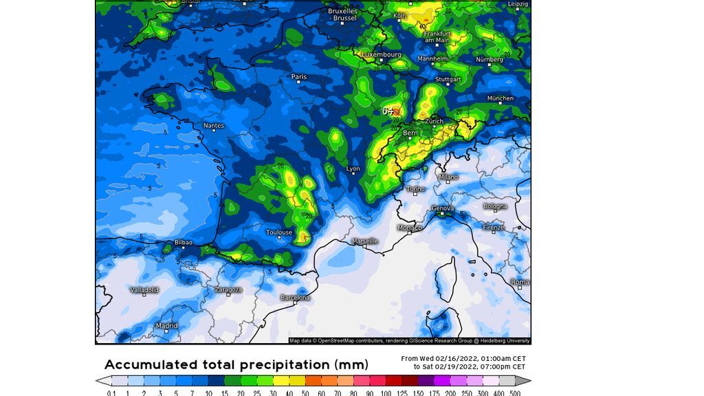
France will receive a fair amount of rain and snow, especially in the regions of Burgundy, Auvergne, Occitanie and New Aquitaine, although without becoming important in the southeast of the country, where the drought situation is critical.
–

Amount of precipitation predicted by the ECMWF/Meteologix modeltelecinco.es
—
“Many stations around the Mediterranean have not seen daily rainfall of at least 1mm (litre per square metre) since the beginning of the year. We can mention Marignane, Salon-de-Provence, Nîmes, Montpellier, Aigues-Mortes, Sète, Hyères, the island of Levant or Toulon”, details the French meteorological agency, Meteo France.
–
Rainfall will not reach Spain
The dry winter is not coming to an end in Spain. Our country is under the influence of an anticyclone, which is acting as a shield that is driving ocean disturbances to the north and east of the continent, without passing through our territory.
–
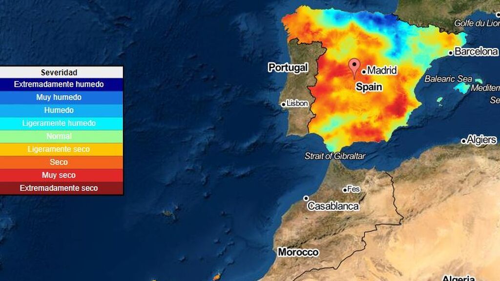
This is causing a general rainfall anomaly across the country. It has rained 36% less than usual in the last four months, and daytime temperatures are much higher than normal, with values more typical of the month of April in some autonomous communities.
–

Meteorological drought monitor / CSIC / AEMETtelecinco.es
—
If the rains do not arrive in February and March, around 80% of the Spanish countryside could be on alert, with crops spoiled. The news is also not good when it comes to the national water reserve: our reservoirs they find each other at 44% capacity in mid-February. Unless the weather forecasts change radically, we will reach spring with a critical situation and possible restrictions on the use of water in much of Spain.
—


