Super Typhoon Pepito Triggers Devastating Storm Surge in Quezon
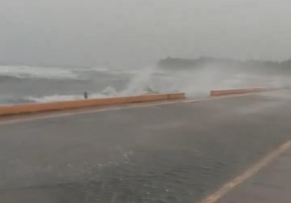
Super Typhoon Pepito, also known internationally as Man-Yi, unleashed its fury on the Polillo Islands in Quezon on Sunday morning, resulting in significant storm surge and flooding across the region. As video footage surfaced on social media showing waves crashing onto roads, local authorities and residents braced for further impacts from this formidable weather system.
A Rising Threat: Typhoon Pepito
Early on Sunday, November 17, 2024, waves were reported reaching the roadway in Polillo Islands, as captured by several netizens. In one striking video from Lhai Abella, a powerful storm surge was observed at the New Baywalk in Barangay Poblacion. As winds intensified, trees swayed ominously, with residents experiencing the brunt of heavy rain and gusts borne from the storm’s core.
The Philippine Atmospheric, Geophysical and Astronomical Services Administration (PAGASA) issued a storm surge warning at 8 a.m. Sunday, emphasizing the potential for life-threatening inundation in low-lying coastal communities. Specifically, areas in the provinces of Quezon, Pangasinan, Aurora, and Camarines Norte are at the greatest risk, with surge estimates projected to exceed three meters in height.
Warnings and Preparations
PAGASA’s bulletin underscored the urgency of the situation, stating, “a high risk of storm surge may occur within the next 48 hours” across multiple coastlines. The storm surge poses threats not only to infrastructure but also to the safety of local residents. As of now, flood warnings remain in effect for many areas, with some communities experiencing substantial inundation due to high waves.
Affected regions have been advised to take immediate precautions, including:
- Staying away from coastlines and beaches
- Canceling marine activities
- Relocating to higher ground away from prone areas
- Following updates from DOST-PAGASA
Further assessments from PAGASA indicated that storm surges of 2.1 to 3 meters could also affect a broader swath of provinces including Ilocos Sur, La Union, Bataan, and even as far south as Albay and Sorsogon.
The Current Situation and Expectations
As of 7 a.m. on Sunday, the eye of Typhoon Pepito was tracked over the coastal waters of Vinzons, Camarines Norte, with maximum sustained winds recorded at 185 km/h. Gusts could reach up to 255 km/h, creating conditions that extend to 300 km from the center of the storm.
On this grim day, Tropical Cyclone Wind Signal (TCWS) No. 5 was issued for the eastern parts of Polillo Islands, specifically Patnanungan and Jomalig, while the remainder of the Polillo Islands faced TCWS No. 4. Status updates regarding the storm’s trajectory and expected implications are crucial as the situation develops.
The Impact on the Community
The impact on communities is profound, with local government units coordinating resources to assist those most affected. Emergency response teams are deployed to assist in rescue efforts, but the unpredictability of the storm heightens the urgent need for residents to remain vigilant.
As communities come together to tackle the challenges posed by Typhoon Pepito, this inclement weather brings not only the threat of damage but also emphasizes the need for ongoing advancements in technology and planning methodologies to better protect vulnerable coastal areas. In light of climate change, adapting infrastructure and emergency protocols becomes increasingly vital in mitigating future disasters of this nature.
As the situation evolves, the next storm surge warning from PAGASA is expected at 2 p.m. Sunday, and residents are urged to stay informed and connected.
Stay tuned for more updates on this developing story, and share your thoughts or experiences with Typhoon Pepito in the comments below. Your insights could help our community better prepare for such weather events in the future.


