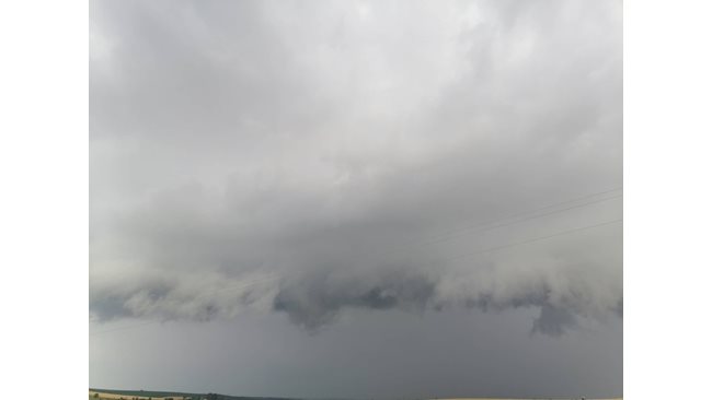
Tornado near Yambol was filmed by Radostin Stoyanov, seen on the Facebook page of Meteo Balkans.
According to weather forecasters, rain fell in many parts of the country on Friday. They will continue until the end of the week.
A strong storm hit Kalofer today. Torrential rains caused floods in Gorna Oryahovitsa. Heavy rain also passed through Veliko Tarnovo. Rain and thunderstorms hit Hissarya. This is only part of the picture in the country.
Cloudy and rainy weather will prevail over most of the country on Saturday night. Heavy cumulonimbus clouds will continue to develop and significant rainfall will fall in many places. The probability of local floods in mountainous areas remains high.
More significant will be the precipitation during the night against Saturday in Western and Central Bulgaria and in places in Northeastern Bulgaria, where precipitation up to 40-50 l / sq.m is not excluded.
On Saturday it will again be cloudy and rainy and in many places, mainly in the mountainous regions of Central and Northwestern Bulgaria, and later in the day over Eastern Bulgaria, will fall significant rainfall, accompanied by thunderstorms. There will be conditions for hail.
It is expected that the total amount of precipitation will reach 20-40 l / sq.m.
The minimum temperatures will rise between 15 ° and 17 ° С. The maximum will be 2-3 degrees higher and will be between 20 and 23 ° C, Meteo Balkans announced.
The weather is expected to improve in the late afternoon, when precipitation from the southwest will gradually stop.
Below is the map of dangerous weather warnings for Saturday. On it are the areas where the probability of dangerous phenomena is highest.
Yellow code is for lightning thunderstorms and torrential rains, as the expected total amount of rain will be between 15-20 l / sq.m. Rainfall over these areas will be mainly in the afternoon and will be in fewer places.
Orange code: Precipitation in many places will be significant. Above these areas they will be mainly in the afternoon and will be accompanied by strong gusts of wind and increased thunderstorms. Storms can carry small and medium-sized hail. In some regions of the country and in the Balkans the expected precipitation can reach 25-40 l / sq.m.
The weather in the mountains
It will remain cloudy and rainy. In the afternoon there will be heavy cumulonimbus clouds. We expect significant precipitation to fall. A moderate to strong wind from the east will blow. The maximum temperature at an altitude of 1200 meters will be about 14 °, at 2000 meters – about 9 °.
The weather on the Black Sea coast
During the night before Saturday the clouds will remain significant and light rain is possible.
During the day there will be heavy cumulonimbus clouds. In many places there will be short-term intense rainfall, in some areas – accompanied by thunder. It will blow to a moderate wind from the eastern quarter. Maximum temperatures will be 20 ° -23 °, close to sea temperature.
PM forecast
No pollution is expected in big cities – the levels of fine dust particles in the atmosphere will be normal.
Weather in Sofia
On Saturday night the weather in the capital will remain rainy. During the day it will be mostly cloudy. We expect significant rainfall over the capital, accompanied by thunder. The expected minimum temperatures will be around 14 ° С, and the maximum – up to 23 ° С.
The weather in the Balkans
Under the influence of a Mediterranean cyclone, the weather on the peninsula will remain rainy. Significant rainfall will fall in the central regions of the Balkans. Significant precipitation is expected over Greece, the Aegean Sea, Bulgaria and Northwestern Turkey.
–


