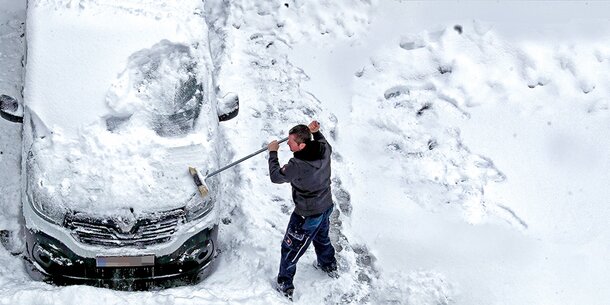
Heavy snowfall set in on Monday with the formation of an Italy low in southern Austria. South of the main ridge of the Alps, thick clouds accumulate and it snows widely, in East Tyrol and Upper Carinthia large amounts of snow are forecast. The snow line sinks slowly to positions between 600 and 800m above sea level.
In Carinthia, the largest amounts of fresh snow will come together in the Carnic Alps and the Karawanken. From Friesach to St. Andrä in Lavanttal, the snowfall could be less intense.
In East Tyrol, most of the snow falls in the Lienz Dolomites. During the course of the day, the snowfall spreads across Tyrol.
The largest amount of new snow will come together in Lungau today in Salzburg. In the northern Salzburg districts it is usually still dry at first, here the snowfall only becomes more frequent in the afternoon.
–
–
Snow and storm warning from ZAMG
The ZAMG published a weather warning for the following regions:

© ZAMG
–


© ZAMG
–
The forecast for your state
Wien. At the start of the week, the sun appears only intermittently alongside numerous dense clouds. From the middle of the afternoon, rain finally sets in from the south. The wind from the south is brisk to strong. The temperatures in the morning around 1 degree. During the day up to 5 degrees are reached.
Lower Austria. A little sunshine and numerous dense clouds determine the weather at the start of the week. During the afternoon, rain finally sets in from the south, which spreads to all parts of the country by evening. The snow line is around 800m above sea level. The wind comes from the south and blows lively to strong, especially on the edge of the Alps and over the eastern flatlands. In the morning minus 3 to plus 3 degrees. The daily maximum temperatures are reached with 2 to 7 degrees.
Burgenland. In addition to numerous dense clouds, the sun still shows up at times during the morning hours. In the afternoon, however, the clouds become thicker and rain spreads from the south to all charging points. The snow line sinks to locations around 800m above sea level. The southeast to south wind blows briskly, in the middle and in the north also strong. After minus 3 to plus 3 degrees in the morning, the temperature rises to 5 to 8 degrees during the day.
Oberösterreich. Clouds predominate on Monday and the sun rarely shows up. It stays dry until at least noon, in the afternoon and towards evening there are temporary showers from the southwest, the snow line is between 500 and 800 m. In the southern mountainous region there is sometimes a stormy southern foehn, gusts of up to 90 km / h are possible there in foehn strokes. Lowest values: -7 to -3 degrees, high values: 0 to 6 degrees.
Salzburg. On Monday it snows in the Lungau and directly on the Tauern main ridge from dense clouds, over noon and in the afternoon sometimes heavily. The clouds also predominate north of the Tauern, only temporarily the stormy southern foehn tears gaps in the cloud cover. In the afternoon and evening, snow showers pass through there too, and rain can mix in at low altitudes in Flachgau. The foehn is strongest in the Tauern valleys, where gusts of 90 km / h are possible. Lowest values: -12 to -4 degrees, high values: -2 to 4 degrees.
Steiermark. On Monday there was a stormy foehn current and during the day snowfall from the southwest, in very low altitudes partly also rain. By noon the precipitation area reaches the upper Murtal and western Styria, and in the course of the afternoon it covers all of Styria. Most of the precipitation is in the Upper Murtal, otherwise the amounts are not too large. Daily highs 0 to +4 degrees.
Carinthia. Snowfall coming from the southwest on Monday. In the Gail and Lesach valleys, it snows early in the morning, and during the course of the day the snowfall spreads across Carinthia. Heavy snowfall can also be expected in the west and south around noon. Significantly less precipitation falls in the eastern Lower Carinthia, and here the snowfall can sometimes turn into rain at low altitudes with a strong refreshing south wind. In the late afternoon the precipitation generally subsides again. Maximum values between -3 degrees in the valleys of Upper Carinthia and occasionally up to +3 degrees in the eastern parts of the country with foehn.
Tirol. Turbulent weather conditions on Monday. In East Tyrol and in the south of North Tyrol, from Paznaun to the rear of the Zillertal, it snows heavily. The most productive snowfall is foreseen in the south of East Tyrol. In addition, a storm blows on the mountains from the south, which in North Tyrol initially reaches into the valleys as a strong to stormy southern foehn. After the end of the foehn, light to moderate snowfall sets in in the afternoon in the rest of North Tyrol. Lowest values: depending on the influence of the hairdryer, between -10 and +3 degrees. Maximum values: -4 to +3 degrees, the coldest in East Tyrol.
Vorarlberg. Monday starts cloudy and still heavily foehn. Around noon the foehn gives way to light to moderate snowfall. In the Rhine Valley and Lake Constance it is partly snowfall, partly rain. Towards evening the precipitation subsided everywhere and the clouds loosen up. Lowest values: very different due to the hair dryer, but mostly -7 to 0 degrees. Maximum values: -2 to +4 degrees.
–
– .


