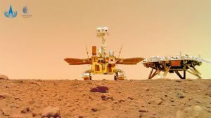
Pengorbit Tiongkok Tianwen 1 – Image from The Eurasian Times
Beijing, Bolong.id – Chinese satellite Tianwen-1 capture the latest pictures of the planet mars, on Wednesday (29/6/2022). China’s National Space Administration (CNSA) said the Tianwen-1 mission had achieve all its goals.
Reported from The Eurasian Times, Saturday (2/7/22), the probe obtained data, including medium resolution images covering the entire planet mars, and completed exploration tasks with various scientific payloads.
The photos, which the space agency shared on social media, show the rugged terrain of the mars landscape, including the south polar ice cap, shield volcanoes, impact craters, and the cliffs and ridges of the Valles Marineris canyon, one of the largest canyons in the solar system, CNN reports.
The images were collected by the orbiter probe, which makes 1,344 orbits around Mars and takes pictures of the planet from all directions as the rover probes the surface, according to CNSA.
It also reportedly obtained images of Mars’ south pole, where nearly all of Martian water is believed to be locked in. Finding water on the red planet would be the first step towards the potential for life on the Martian surface.
The thirteen scientific payloads mounted aboard the Tianwen-1 Mars mission have collected 1,040 gigabytes of genuine scientific data after two years of operation and planetary exploration.
Ground crews process data to create standard scientific products, which are then sent monthly to scientific research teams for further analysis and investigation.
Relevant scientific achievements have been published in well-known academic journals, both at home and abroad.
According to CNSA, scientific data will be available to researchers around the world, including US NASA and European ESA, in a timely manner.
They will be welcome to submit research on data to advance mankind’s exploration of the universe.
–

