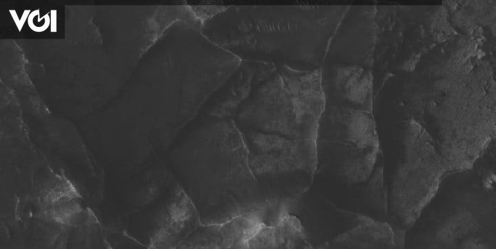
JAKARTA – Over the past two decades, scientists have discovered a network of unusual ridges on Mars, using images from spacecraft orbiting the Red Planet.
But they do not know how the mountains were formed. To study Mars, a team of scientists, led by Aditya Khuller from School of Earth and Space Exploration Arizona State University and Laura Kerber of NASA’s Jet Propulsion Laboratory involved thousands of citizen scientists.
They were engaged to help map the unusual ridge feature in the planet’s Jezero crater. Their findings, recently published in Icarus, suggest that mountains on Mars may hold a fossil record of ancient groundwater flowing through them billions of years ago.
NASA’s rover Perseverance and the Ingenuity helicopter are currently exploring the area near the crater.
Researchers from Arizona State University and NASA’s Jet Propulsion Laboratory invited the scientists to help classify data from a number of orbiting Mars instruments, including NASA’s Mars Odyssey THEMIS camera and the Mars Reconnaissance orbiter’s CTX and HiRISE instruments.
Through the Zooniverse platform, citizen scientists identified a total of 953 polygonal ridge networks in an area that covers about 20 percent of the Martian surface.
“Citizen scientists played an integral role in this study because these features are basically patterns on the surface, so almost anyone with a computer and the internet can help identify these patterns using images of Mars,” said Khuller.
–
–
–
Launch Digital TrendsMonday, April 11, the network of ridges most commonly identified in the very old terrain is up to 4 billion years old, which is around the time Mars is thought to have had liquid water flowing on its surface.
Similar ridges have been found to contain clay in previous studies, this is important because clay tends to form in the presence of water.
Although many mountains on Mars are now covered in dust, which makes them difficult to analyze, this suggests that they could have been formed by water flowing on or near the surface. The researcher wants to continue to invite the community to help with the mapping work.
“We hope to eventually map the entire planet with the help of citizen scientists. If we’re lucky, the Mars 2020 Perseverance rover may be able to confirm these findings, but the closest mountain ranges are several kilometers away, so they may only be visited on potentially extended missions,” Khuller said.
–

