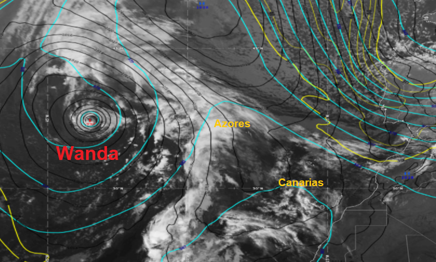
According to the latest NHC reports, Wanda is moving north with no change in intensity. As of November 3 and 03 UTC, the tropical storm was 1170 km west of the Azores with maximum winds of 85 km / h. Its minimum pressure was 992 hPa.
Wanda travels over open water and will not affect land areas. Little change in strength is expected over the next few days.
Convection bands have continued to increase and decrease around the center of Wanda for the past 6-12 hours, with a band currently located over the western part of the cyclone.
The winds estimated by satellite detected maximum winds of around 40 kt and given the known subsampling of this instrument for small tropical cyclones, the initial intensity of 45 kt is maintained. The data do not show that the tropical storm force wind area has increased in size over the eastern semicircle.
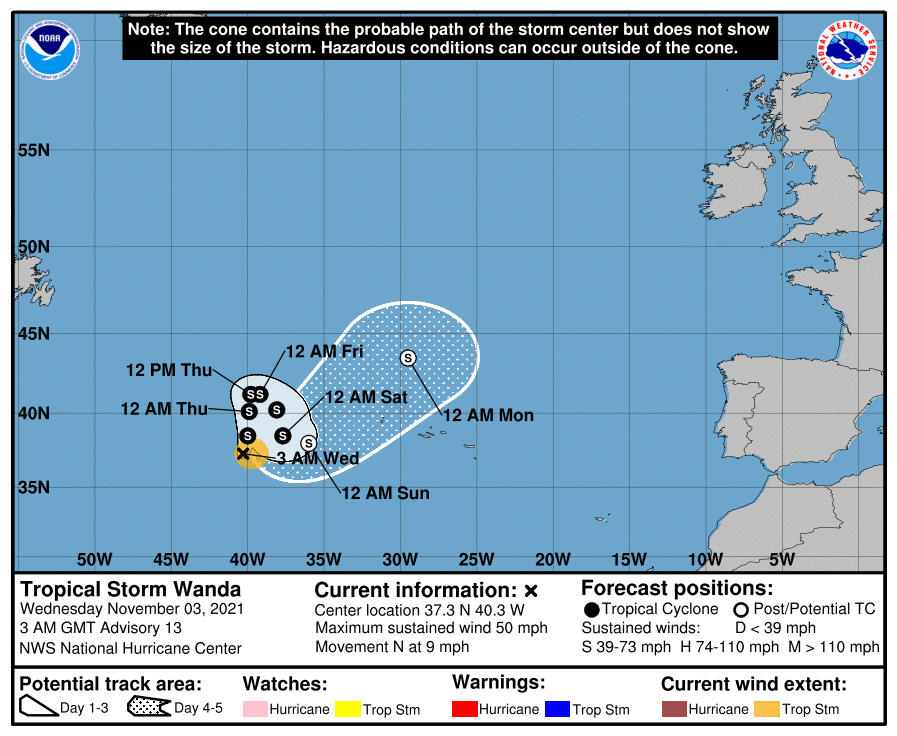
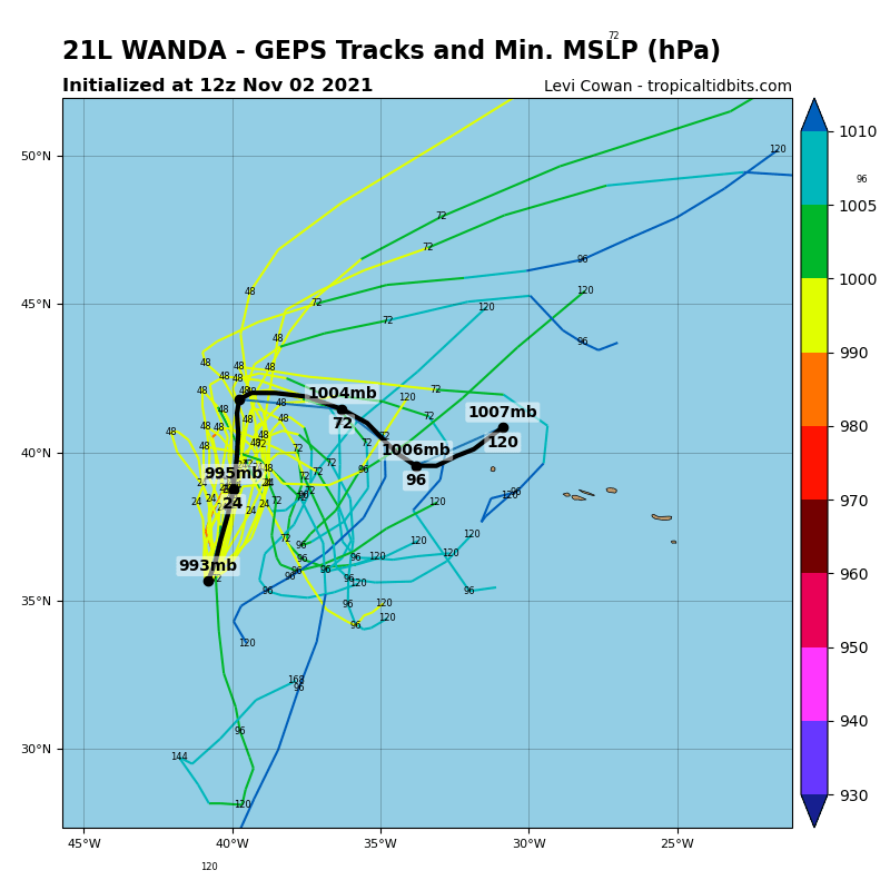
The tropical cyclone should continue to move north ahead of a mid-latitude trough that will approach during the next 24-36 hours. However, after that time, the trough is expected to weaken and drift north, causing Wanda to slow down and turn east.
A small overall change in strength is anticipated over the next few days. As Wanda moves north over the next day, it will move over slightly cooler waters, which could cause the cyclone to struggle to produce deep convection. After day 2, there are signs of increased shear, but a nearby ripple could help the system maintain its intensity.
Later, shear and declining mid-level relative humidity will likely cause Wanda to become posttropical, and by day 5 the forecast guidance indicates that Wanda will merge with a frontal boundary and become extratropical.
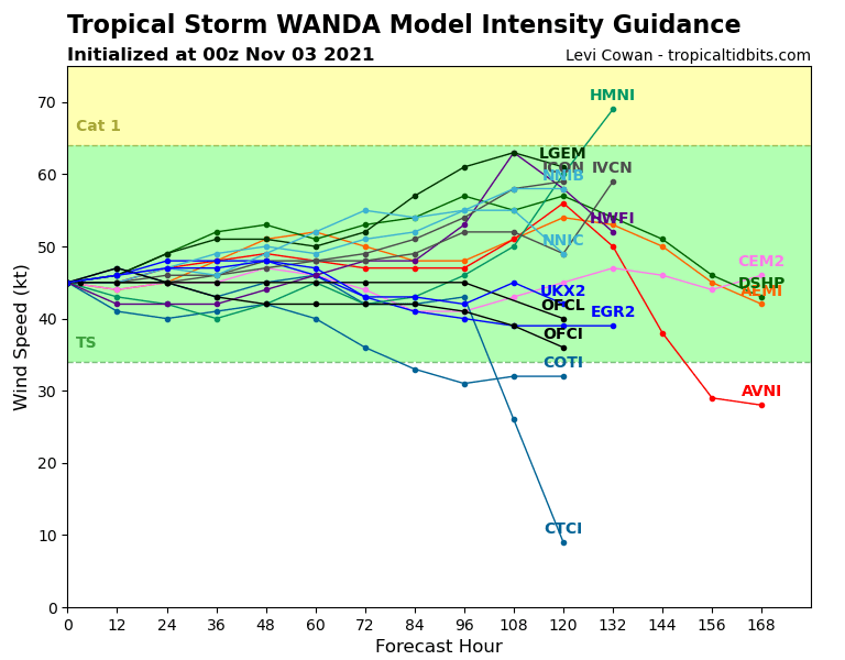
Being a relatively small storm, the predictions of its trajectory and intensity have high uncertainty.
Wanda is the tropical storm with the 21st name which takes place in the Atlantic this year. The official 2021 list is now complete of names for the 2021 hurricane season. The next additional tropical storm, which forms in the Atlantic until the end of this season, would bear the name of Adria, the first of a complementary list.
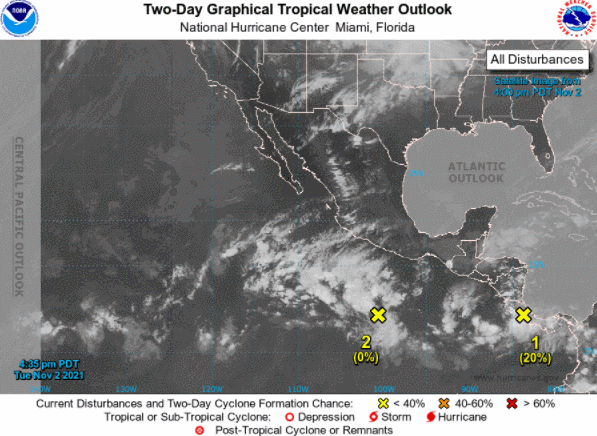
The rest of the tropical Atlantic is very calm and no area formation or monitoring is expected within 5 days.
In contrast, two zones are monitored in the Northeast Pacific by the NHC, as shown in the following image.