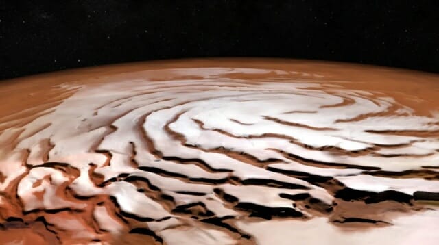
A 3D radar image of the north pole of the red planet ‘Mars’ has revealed hidden canyons beneath the surface.
US IT media Cnet reported on the 28th (local time) that researchers at the US Planetary Science Institute (PSI) have created a 3D map of Mars’ North Pole using radar data collected by NASA’s Mars Reconnaissance Orbiter (MRO) .
The image, called a “radargram,” highlights never-before-seen Martian features, such as Martian impact craters and buried canyons. The researchers published their findings on the 28th in the international journal “The Planetary Science Journal”.
The MRO is equipped with a ground penetrating radar (Sharad) instrument that allows scientists to see below the surface. The research team processed the data collected with this equipment into 3D images. In the image above, the black ellipse marked as the “dataless zone” is the area that Sharad did not photograph.
Sharad was developed to find liquid or frozen water on Mars, but radar can also see what’s happening to Martian rocks and sand. This helps scientists understand how Martian geological layers were deposited and eroded at the poles.
Related articles

The research team said the research so far is only a first step in understanding the formation process and climate history of the Martian polar regions and that much work remains to be done.
In the future, researchers will identify more buried impact craters and understand the structure of the underworld. Moreover, this technology can be used not only in the North Pole of Mars, which was filmed this time, but also in other regions.
![The North Pole of Mars, I saw it on a new 3D map… “Subterranean canyon exposed” [여기는 화성] The North Pole of Mars, I saw it on a new 3D map… “Subterranean canyon exposed” [여기는 화성]](https://image.zdnet.co.kr/2022/11/29/425ba799418b87df246949cf6c1462cb.jpg)

