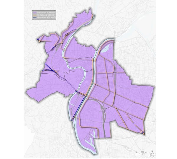
From March 30, almost all Lyon streets will now be limited to 30 km / h to allow “appeasement of public space”.
Notice to Lyon motorists. From March 30, traffic in the majority of streets in Lyon will increase to 30 km/h. “City 30 applies to all users of public space: by car, van, truck, motorcycle, scooter, bus, bicycle, scooter”, warns the City.
More than 80% of the streets concerned
Previously, only 37% of streets in Lyon were affected by the 30 km/h limit. They will now become the norm, with more than 80% of Lyon streets affected.
What are the exceptions? Only the main roads will remain limited to 50 km / h, in particular along the quays of the Rhône, the avenues Berthelot and Tony Garnier, the Cours Gambetta and Lafayette, the rue Garibaldi, the tunnel of the Croix-Rousse or the boulevard des Belges .
All the new speed limits can be found on the map below or on the interactive map of the city.

“In the wake of other European cities such as London, Oslo, Valencia in Spain, Paris, Brussels, or closer to us, Grenoble or Oullins, Lyon has chosen to slow down the speed, to better accelerate well-being and health of its inhabitants”, recalled the mayor Grégory Doucet in a press release.
The goal is to reduce the number of accidents and noise pollution, while making the sharing of public space more pleasant.
–


