Updated Dec 4 at 11:55
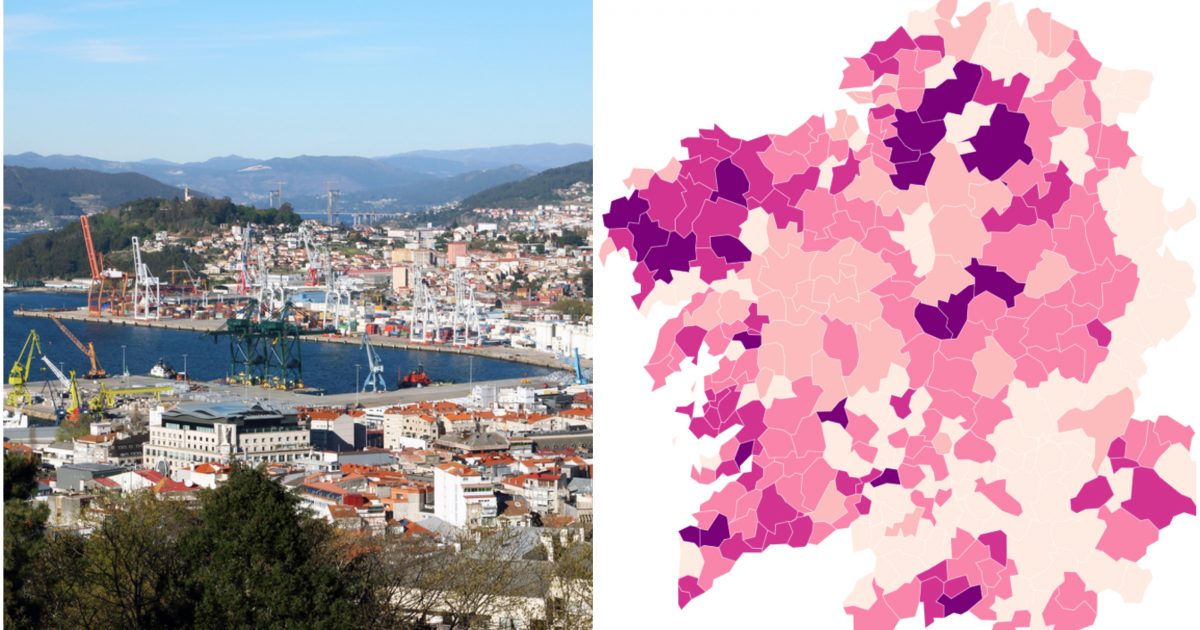
One more day we review the incidence of all Galicia with lists, tables and maps, starting with the seven cities and their areas. We also tell you which are the 20 Galician municipalities above 500 incidence, and we show you maps of the entire community and its four provinces.
The incidence in the seven cities and their areas
This is the incidence in the cities of Galicia, in order from lowest to highest.
- Santiago de Compostela: 87 (-12)
- Ames: 63 (-16)
- Boqueixón: 71 (=)
- Oroso: 147 (-26)
- Teo: 81 (-5)
- Ourense: 109 (-11)
- Barbadás: No specific data, less than 10 infections in 14 days.
- Pereiro de Aguiar: No specific data, less than 10 infections in 14 days.
- San Cibrao das Viñas: 0 (=)
- A coruña: 151 (=)
- Abegondo: 425 (=)
- Arteixo: 170 (=)
- Bergondo: No specific data, less than 10 infections in 14 days.
- Cambre: 130 (-32)
- Carral: No specific data, less than 10 infections in 14 days.
- Culleredo: 230 (+6)
- Potters: 69 (-3)
- Now: 82 (-6)
- Ferrol: 191 (-3)
- Ares: No specific data, less than 10 infections in 14 days.
- Fene: 131 (-47)
- Mugardos: No specific data, less than 10 infections in 14 days.
- Narón: 287 (-15)
- Neda: No concrete data, less than 10 infections in 14 days.
- Lugo: 225 (-4)
- Vigo: 222 (-10)
- Bayonne: 625 (+27)
- Cangas: 192 (-8)
- Gondomar: 896 (+14)
- Moaña: 289 (-20)
- Mos: 232 (+13)
- Nigrán: 153 (-11)
- O Porriño: 237 (+5)
- Pazos de Borbén: No specific data, less than 10 infections in 14 days.
- Redondela: 339 (-55)
- Salceda: 360 (-109)
- Salvaterra de Miño: 275
- Pontevedra: 277 (-8)
- Marin: 218 (-20)
- Poio: 304 (-12)
The 20 municipalities with more than 500 incidence
These are the 20 municipalities with the highest incidence in Galicia, exceeding 500, updated with the latest data from the Xunta, and below we show you the incidence maps for all of Galicia and the data tables for all the municipalities. It should be taken into account that in several municipalities the data is extremely high because of the low population (Beariz has less than 1,000 inhabitants, and Irixoa about 1,300).
- Beariz (Ourense): 3,502
- Irixoa (A Coruña): 1,724
- Castrelo de Miño (Ourense): 1,523
- Guntín (Lugo): 1,115
- Muxía (A Coruña): 1,074
- Vilaboa (Pontevedra): 1,048
- Baltar (Ourense): 1,040
- Antas de Ulla (Lugo): 962
- As Pontes (A Coruña): 917
- Gondomar (Pontevedra): 896
- Mazaricos (A Coruña): 875
- Monfero (A Coruña): 828
- A Baña (A Coruña): 812
- Valga (Pontevedra): 801
- Coristanco (A Coruña): 774
- Aranga (A Coruña): 757
- Baiona (Pontevedra): 625
- Monterroso (Lugo): 608
- Vilalba (Lugo): 505
- Dumbría (A Coruña): 503
To prepare these maps and tables, we have taken the new data from the Xunta, calculated the exact incidence of all the municipalities in Galicia and prepared five new maps that show the level of involvement of each municipality at the community and provincial level. The data is accurate when the municipality has had 10 or more cases in the last 14 days or has had none. In the event that you have had between 1 and 9 cases, the Xunta de Galicia does not specify the exact number, so we have taken 3 as a reference value. The incidence data of the municipalities between 1 and 9 cases is therefore not real, but an approximation. In the rest of the Galician councils, the data is exact taking as reference the last data of inhabitants of the Galician Institute of Statistics.
From now on this data will be updated on this page every day minutes after 11:00 in the morning, along with the other daily reports of the coronavirus that we do in Fifteen thousand and thirty six.
Incidence maps in Galicia and its provinces
https://datawrapper.dwcdn.net/2JUFt/11/
https://datawrapper.dwcdn.net/QeLK2/14/
https://datawrapper.dwcdn.net/jXVbb/12/
https://datawrapper.dwcdn.net/QU6lS/11/
https://datawrapper.dwcdn.net/mQeuA/10/
The areas of Galicia most affected
In numbers, the most affected municipalities in Galicia are those in which a relatively high number of cases coincide with a very low population, which gives rise to an absolutely exaggerated incidence of new cases per 100,000. Taking a look at the map of Galicia in general, these are the most affected areas of the community.
- Bergantiños and Costa da Morte: By far the area with the highest incidence in recent weeks. The Bergantiños region almost entirely has an incidence of more than 500, not only in sparsely populated municipalities such as Cabana, Coristanco or Malpica, but also in Carballo, with an incidence of 545 and the third highest number of cases in the province of A Coruña. Municipalities in the rest of Costa da Morte such as Vimianzo, Muxía or Dumbría also have a high incidence.
- Interior of Betanzos and Eume: Pontedeume and nearby municipalities such as Monfero, Irixoa, Aranga and Paderne have a high incidence.
- Pontevedra Rías Baixas: With exceptions such as Catoira, Vilagarcía, Cangas or Bueu, from Vilanova de Arousa to A Guarda there is a high incidence of coronavirus.
- Other places: Vilalba in Lugo (due to the resurgence of a residence), Antas, Guntín and Monterroso south of Lugo city, A Rúa in Ourense and Xinzo de Limia and the neighboring Baltar, also in Ourense, are other places with a high incidence.
Incidence data by province
These data tables show the infections and the incidence in Galicia in the last 14 days.
https://datawrapper.dwcdn.net/Vdwmj/11/
https://datawrapper.dwcdn.net/7MG5C/11/
https://datawrapper.dwcdn.net/u3fKC/11/
https://datawrapper.dwcdn.net/xnABt/10/


