The weather will not clear until Thursday morning, according to the Meteorological Institute. They expect up to 10–25 millimeters of rain in some hours.
This caravan was smashed to pieces after it was taken by the flood and drove into a bridge in Hemsedal.
Published: 08/08/2023
Updated: 08/08/2023 23:11
– We are sticking to the notice we have out. As it looks now, it is the areas furthest west in the interior that receive the most rainfall. That’s what Anne Solveig Andersen, state meteorologist on duty, said late on Tuesday evening.
The forecast indicates that there will still be a lot of rain. In western areas, between 10 and 25 millimeters of rain can fall in the most intensive hour, which in many places means the heaviest rain in 25 years. It is expected to fall between 50 and 70 millimeters per day until lunchtime on Wednesday.
25 millimeters of rainfall corresponds to 25 liters of water per square meters.
– There are quite a few showers this evening and tonight, so it is a bit difficult to say exactly where they will hit and how powerful they will be. At the same time, it will continue to rain steadily, says Andersen.
– It seems that things will gradually improve and the weather will stay calm on Thursday, but it seems that the rainfall may continue for quite some time during the day as well. Staying weather is expected on Friday, he says.
A good amount of precipitation is expected in Oslo on Wednesday, but the amounts are not extreme. There is still a risk of flooding.
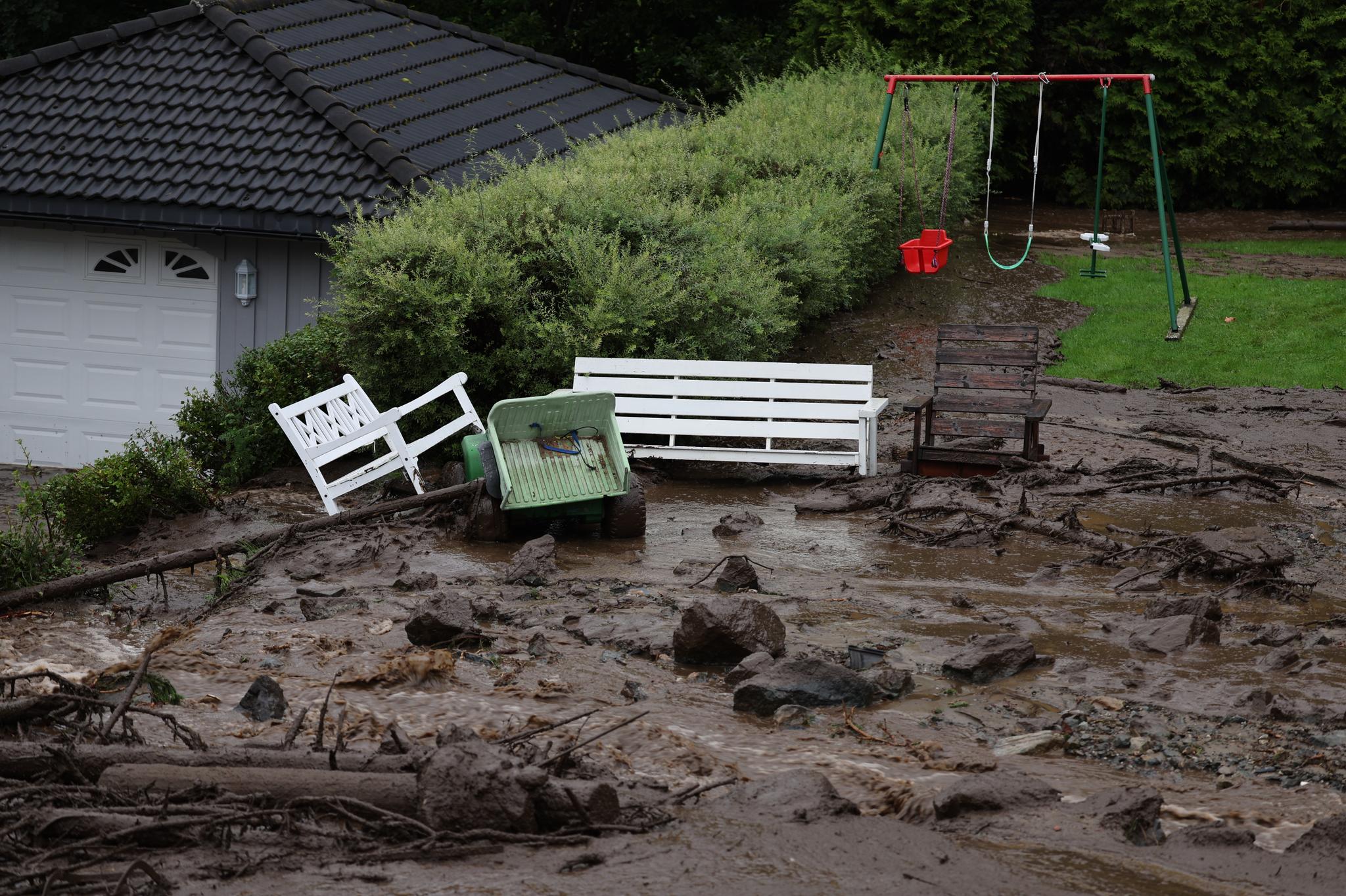
The pictures Aftenposten’s photographer took in Valdres on Tuesday show a valley strongly marked by extreme weather. Photo: Stein J. BjørgePhoto: Stein J. BjørgePhoto: Stein J. BjørgePhoto: Stein J. Bjørge
A long series of events
On Tuesday, NVE extended the red flood warning to also apply on Thursday for Innlandet and Viken.
There have been several large landslides in the last 24 hours. The municipalities of Lom, Valdres and Hol have been badly hit, and many roads have been closed as a result of the landslides. In Vang in Valdres, there has been as much rainfall in one day as there is normally in the whole of August. 88.5 mm of precipitation has been recorded here. Dozens of roads have been closed due to the storm, and several train routes have also been canceled on Wednesday. The police are asking people in Holsfjorden, which stretches across Hole and Lier municipalities, to evacuate. In the past, there have been several landslides in the area. The 110 center in the East police district has received over 250 inquiries for assistance after water intrusion into buildings.
The Drammens watercourse is rising
NVE states that they expect a delayed flood peak in the Drammensvassdraget, which is heading towards the flood peak on Friday.
– The Drammens watercourse is particularly vulnerable and has a strongly rising water flow, writes NVE.
According to NRK, NVE fears that the Drammensvassdraget will flood beyond its banks. To the channel, the emergency manager in the municipality says that he is asking all those who live along the river to take the necessary precautions.
– Everyone who lives at risk of flooding should secure their assets. If the worst-case scenario occurs, the water could rise to 3.5 meters at the Mjøndalen bridge. Then many properties will be affected, emergency manager Sten Petter Aamodt says NRK.
Heavy showers can cause water flow at red level in several rivers and streams during Tuesday and Wednesday. This will lead to extensive flooding, erosion damage and flood damage in exposed locations, according to NVE.
Major floods in store
NVE said on Tuesday evening that they are very concerned about the Drammensvassdraget in terms of flooding.
A number of rivers and waterways now move enormous amounts of water to Krøderen, Randsfjorden and Sperillen. These lakes lead water into the Tyrifjorden and further down the Drammenselva.
NVE expects that the water will rise by 1 to 3 meters from today’s levels in the future.
– All these are record water levels, says Sjur Kolberg, who is a hydrologist at NVE.
He says that the flood peak will occur towards the weekend, but that there is great uncertainty when the peak appears.
– We have to count on water in cellars and water well into the fields now that roads are closed. This will cause damage.
Mjøsa is not a record high, although there is a lot of water. Kolberg says that there is also a red alert for landslides in several places.
– There is a high risk of flash floods and landslides. This usually happens during or just after the worst downpours, says Kolberg.
2023-08-08 20:32:32
#Violent #flooding #ahead #water #rise #meters #weekend #NVE


