
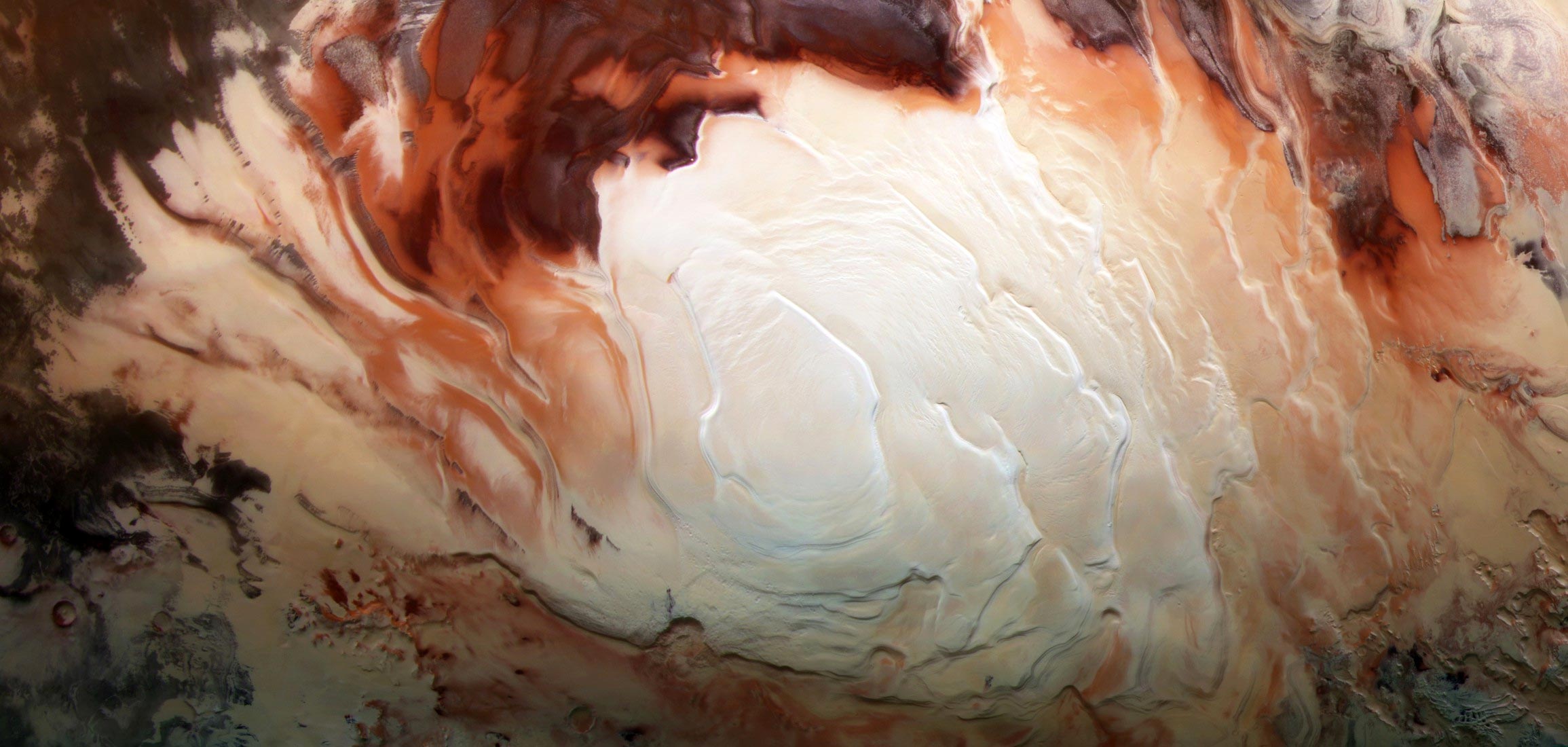
The bright white area of this image shows the ice sheet covering Mars’ south pole, made up of frozen water and frozen carbon dioxide. ESA’s Mars Express recorded this area of Mars on December 17, 2012 with a high-resolution stereo camera in infrared, green and blue light. Photo credit: ESA / DLR / FU Berlin / Bill Dunford
–
A new paper finds more radar signals indicating the presence of underground “lakes,” but many of them are in areas that are too cold for the water to remain liquid.
In 2018, scientists working with data from the ESA’s (European Space Agency) Mars Express orbiter made a surprising discovery: a signal from a radar instrument reflected from the Red Planet’s South Pole appeared to reveal a liquid lake beneath the surface. Several such considerations have already been announced.
In a new article published in the magazine Geophysical research letter, two scientists at NASA’s Jet Propulsion Laboratory in Southern California explain that they found dozens of similar radar reflections around the South Pole after analyzing the wider Mars Express data set, but many of them in areas that would otherwise be too cold to store liquid water.
“We’re not sure whether these signals are liquid water or not, but they appear to be much more common than what the original paper found,” said Jeffrey Plaut of JPL, investigator at MARSIS (Mars Advanced Radar for Subsurface and Ionospheric Sounding). ) Instrument jointly developed by the Italian Space Agency and JPL. “Either liquid water is common under Mars’ south pole, or this signal suggests something else.”
The Mars Express from ESA (European Space Agency) flies over the red planet in this image. NASA’s Jet Propulsion Laboratory supplies receivers for the Mars Advanced Radar for Subsurface and Ionosphere Sounding (MARSIS) instrument. Photo credit: ESA/NASA/JPL-Caltech
–
Frozen time capsule
Originally interpreted as liquid water, the radar signal was discovered in a region of Mars known as the South Pole Layered Deposit, named after the water ice, dry ice (frozen carbon dioxide) and dust that have been deposited there for millions of years. . It is believed that these layers provide a record of how Mars’ axial tilt has shifted over time, just as changes in Earth’s tilt have created ice ages and warmer periods throughout our planet’s history. When Mars had a smaller axial tilt, snowfall and layers of dust accumulated in the region, eventually forming the thick ice sheets found there today.
By shining radio waves on the surface, scientists can see beneath this ice sheet and map it in detail. Radio waves lose energy as they penetrate underground material; Because they are reflected back to the spacecraft, they usually have a weaker signal. But in some cases, the signals returning from below the surface of this region are brighter than those on the surface. Some scientists have interpreted this signal to indicate the presence of liquid water, which strongly reflects radio waves.
Plaut and Aditya Khuller, an Arizona State University PhD student who worked on the work during an internship at JPL, aren’t sure what the signal means. The area believed to contain liquid water stretches for 10 to 20 kilometers in a relatively small region of Mars’ South Pole. Khuller and Plaut expanded the search for equally strong radio signals to 44,000 measurements, spread over 15 years of MARSIS data across Mars’ south polar region.
The colored dots represent the locations where bright radar reflections were detected by the ESA Mars Express orbiter at Mars’ south pole. Such reflections were previously interpreted as underground liquid water. Their prevalence and proximity to cold surfaces suggests that it may be something else. Photo credit: ESA/NASA/JPL-Caltech
–
Unexpected ‘lake’
The analysis found dozens of additional bright radar reflections over a much greater area and depth than before. In some places they are less than a mile from the surface, where temperatures are estimated to be minus 81 degrees Fahrenheit (minus 63 degrees Celsius) — so cold that water would freeze, even if salty minerals known as perchlorates could lower the freezing point of water.
Khuller note papers from 2019 where researchers calculated the heat needed to melt the region’s underground ice and found that only new subsurface volcanism could explain the potential presence of liquid water beneath the South Pole.
“They found that it would take twice the estimated Martian geothermal heat flux to maintain this liquid water,” Khuller said. “One possible way to get that amount of heat is through volcanism. However, we haven’t seen really strong evidence of recent volcanism at the South Pole, so it’s unlikely that volcanic activity would allow liquid water to exist below the surface in this region.”
What explains the bright reflection if it is not liquid water? The author cannot say for sure. But their paper provides scientists with detailed maps of the region that provide clues to Mars’ climate history, including the role water plays in its various forms.
“Our mapping brings us several steps closer to understanding the extent and causes of these mysterious radar reflections,” Plaut said.
Reference: “Characteristics of the Martian South Pole Layered Basalt Interface” by Aditya R. Khuller and Jeffrey J. Plaut, June 16, 2021, Geophysical research letter.
DOI: 10.1029 / 2021GL093631
–