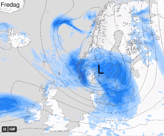
“Otto” can produce wind gusts of 32–35 m/s. The Meteorological Institute can issue danger warnings.
On Friday, a low pressure, which can produce wind gusts of 32–35 m/s, hits Norway and Denmark.
It is the Danish Meteorological Institute that has given the low pressure the name “Otto”.
– We are assessing the situation, and it may well be that there will be some danger warnings for Friday, writes the Meteorological Institute.
Danish TV 2 writes that “Otto” may become the strongest storm in Denmark in several years.
An orange warning has been issued for gusty winds in North Jutland and northern West Jutland.
– It currently does not look like it will be the case in Norway. But we cannot rule out that there will be extreme weather, says on-duty meteorologist Iselin Skjervagen at the Meteorological Institute.
The institute considers which danger warnings they should send out.
– For the time being, it is unclear whether there will be a yellow or orange warning for southern Norway, says Skjervagen.
She states that it looks like there may be wind gusts of between 33–35 m/s – and storms are expected in medium windmedium windThe average wind speed during ten minutes.
– This will come to us during Friday. It seems that it will be worst in the evening, but it will probably be quite wet and quite windy, says Skjervhagen.
“Otto” will hit southern Norway, but exactly where is currently difficult to say.
