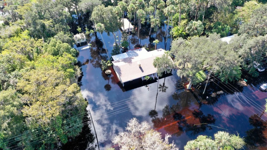
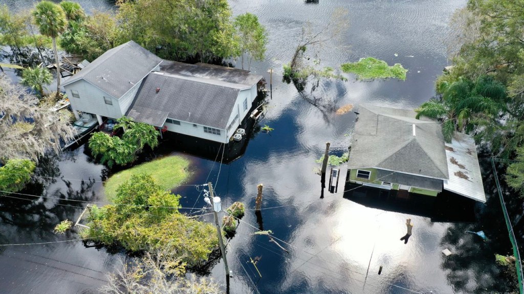
(CNN) – Hundreds of homes in central Florida remain submerged in widespread flooding as the St. Johns – a notoriously slow river on the peninsula’s eastern side – slowly drains historic levels of rainfall left by Hurricane Ian nearly two weeks ago.
The river will, at least for next week, be at its highest level in nearly 60 years, according to forecasts. And the National Weather Service (NWS) has warned that water may remain above the flood stage during Thanksgiving.
In Seminole County, northeast of Orlando, there are more than 400 homes “inaccessible” due to flooding, according to County Planner Steven Lerner. The city of Geneva, which lies in a bend in the river and between two lakes, suffers from extensive flooding.
“Historically, this area is prone to flooding and many residents cling to the end” in their homes, Lerner told CNN in a telephone interview. The official did not know for sure how many inhabitants had already fled the place due to the floods.
The St. Johns River begins southeast of Orlando and flows north through dozens of cities on the eastern side of the Florida panhandle, before flowing into the Atlantic Ocean in Jacksonville.
The river flows for 300 miles, but its elevation gain is around 30 feet, making it one of the slowest rivers in the world, according to Scott Kelly, an NWS meteorologist in Melbourne.
“It’s a very, very slow river,” Kelly told CNN. “Very slow motion,” she added.
Kelly suspects the flooding could continue “maybe for a couple of months”. And, along the same lines, authorities expect this slow disaster to move north in the coming weeks.
The water in Geneva “will eventually move to the Astor area,” Lerner said. “It’s a very slow descent process.”
Astor is an unincorporated community in Lake County, located on the western side of the river just south of Lake George. Lerner explained that it usually takes two weeks for the water to flow from Geneva to Astor, so people there should expect the water level to rise very soon.
Yet already in DeLand, between Geneva and Astor, drone footage shows houses and businesses flooded with dark brown water, which extends beyond the river banks.
“Geneva … DeLand and Astor had a flood record with this event,” Kelly told CNN. “So this is something no one has seen for at least 70 years,” she said.

Meteorologists say water levels will remain high in St. Johns during Thanksgiving. (Credit: Chris Fau)
Hurricane Ian dumped up to 500mm of rain in this part of Florida nearly two weeks ago, a huge amount of rain that is becoming more common as the planet warms. Scientists have shown that warmer air can hold more moisture, prompting hurricanes to produce more intense rainfall.
According to a quick analysis by scientists at Stony Brook University and Lawrence Berkeley National Laboratory, Ian’s rainfall was at least 10% more due to man-made climate change.


Hurricane Ian pushed the St. Johns River to its highest levels in 70 years (Credit: Chris Fau)
The NWS predicts that the region will receive additional rain in the coming days as a cold front moves through Florida. But Kelly said this won’t raise the river’s current levels.


National Weather Service meteorologists warn that the floods will last for several weeks as St. Johns slowly drains. (Credit: Chris Fau)
“People are probably going to freak out because it’s going to start raining again,” Kelly said. “It will be more erratic rainfall and shouldn’t have a significant impact on the river level,” she added.
Now, forecasters are more concerned with preparing people for weeks of flooding.
“We’re not sure people fully understand that this river isn’t going to go down very fast,” Kelly said.
“So yes, it peaked in most places, but it will stay near or at that point for many days and we don’t think people are mentally prepared for it,” he added.


