
The National Hurricane Center (NWS) has reported that ‘Fred’ as a tropical storm approached landfall on Monday on the Florida peninsula, in the United States. According to the update generated by the NWS at 11:00 a.m. (local time), maximum winds were 60 miles per hour (96.5 km / h).
At the time, the cyclone was located about 55 miles (about 88.5 kilometers) south of the city of Apalachicola, traveling north at a rate of 10 miles per hour (16.09 km / h). A tropical storm warning was immediately issued, extending to the Steinhatchee River. It was learned that could get even stronger before hitting land.
Afforestation an alternative against global warming
–
According to what the NWS said, it was expected to make landfall in the afternoon that same day or in the course of the night. ‘Fred’ could generate 6 to 10 inches (152.4 to 254 millimeters) of accumulated precipitation, with storms that could continue into Georgia and Tennessee, said Ken Graham, director of the NWS.
A storm surge between 1 to 5 feet (30.4 to 152.4 centimeters) could also occur. over the peninsula, particularly between the Florida-Alabama border, up to Indian Pass. It was reported that the most severe flooding could occur near and east of where the cyclone made landfall. In the Keys and South Florida, between 25 and 50 millimeters of rain could accumulate, being able to reach a maximum of up to 127 millimeters.
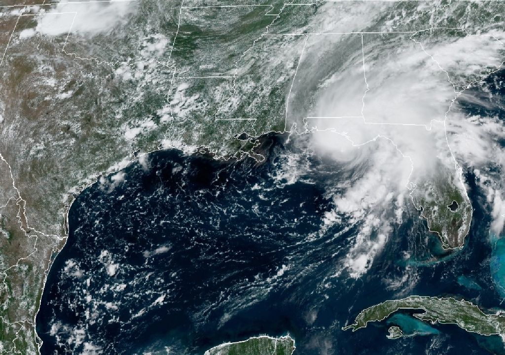
Storm Surge along the coast and flooding rainfall well inland are expected as #Fred comes ashore this afternoon. https://t.co/bFq31sBtEJ
– National Weather Service (@NWS) August 16, 2021
Chance of tornadoes
NWS meteorologists added that it also there was the possibility of tornado formation on the east coast Florida, and in general over the entire peninsular area of this state. It transpired that more than 20 counties were in a state of emergency due to ‘Fred’. This cyclone has been the sixth named within this season.
Remember that was formed on August 10 south of Puerto Rico. The NWS is also monitoring ‘Grace’, tropical storm that was organized with these characteristics last Saturday and with a trajectory apparent towards Haiti and the Dominican Republic. It was said that the Atlantic basin is very active because during this same week another tropical cyclone could be activated.
ATTENTION:
The #Tropical storm #Fred approaching the coast of #Florida USA
-Winds 85km / h
-145km al SSW de Apalachicola Florida
CAUTION ️ heavy rain and dangerous storm surges are expected pic.twitter.com/UHZWKUQkrL– Geol. Sergio Almazán (@chematierra) August 16, 2021
Tropical depression eight getting organized
If the condition occurs, the NWS cited, this would be formed from Tropical Depression Eight, located to the northeast from Bermuda, bearing the name Henri. It should be mentioned that, for this Tuesday meteorologists at the multi-site center expect winds at higher levels to may cause shear that would hinder the development of the storm.
The National Oceanic and Atmospheric Administration Office cited that this was expected to be an above-average hurricane season. forecasting up to 10 hurricanes by the time the season ends on November 30. He added that the most active period extends from mid-August, reaching a peak approximately between September 10 and towards the end of October.
Stay alert and aware of the forecast updates we constantly have for you on Meteored. You can review the very diverse tools that we make available to you for free. Anticipate your trip and prepare your journey with opportunity, consulting the weather on our portal and through the application for smart mobile phones.
–

