A cyclone brings torrential rains and strong winds
A Mediterranean cyclone passes over the Balkans from west to east, creating a rainy situation. At the same time, precisely because of this instability, warmer air is also invading the country, keeping temperatures above normal.
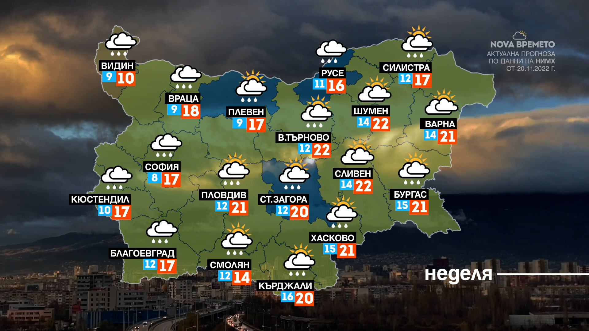
Precipitation in our country has already started in some areas of western and northern Bulgaria. Later in the day it will be cloudy and rain more heavily and in more places in the western half of the country, while in the eastern part it will rain less.
During the day the most significant quantities will fall on the extreme Northwest and on the western mountain ranges. In these areas there are the conditions for the raising of the river level and the activation of landslides. Atmospheric circulation over the next two days will also allow for the formation of cumulus clouds with thunderstorm activity.
On Sunday the wind will remain from the south, particularly strong in the mountains and in eastern Bulgaria. The speed of the gusts will reach 100 km/h. Temperatures will remain above normal and range from about 12-13 in the northwest to about 20 in some areas in the east.

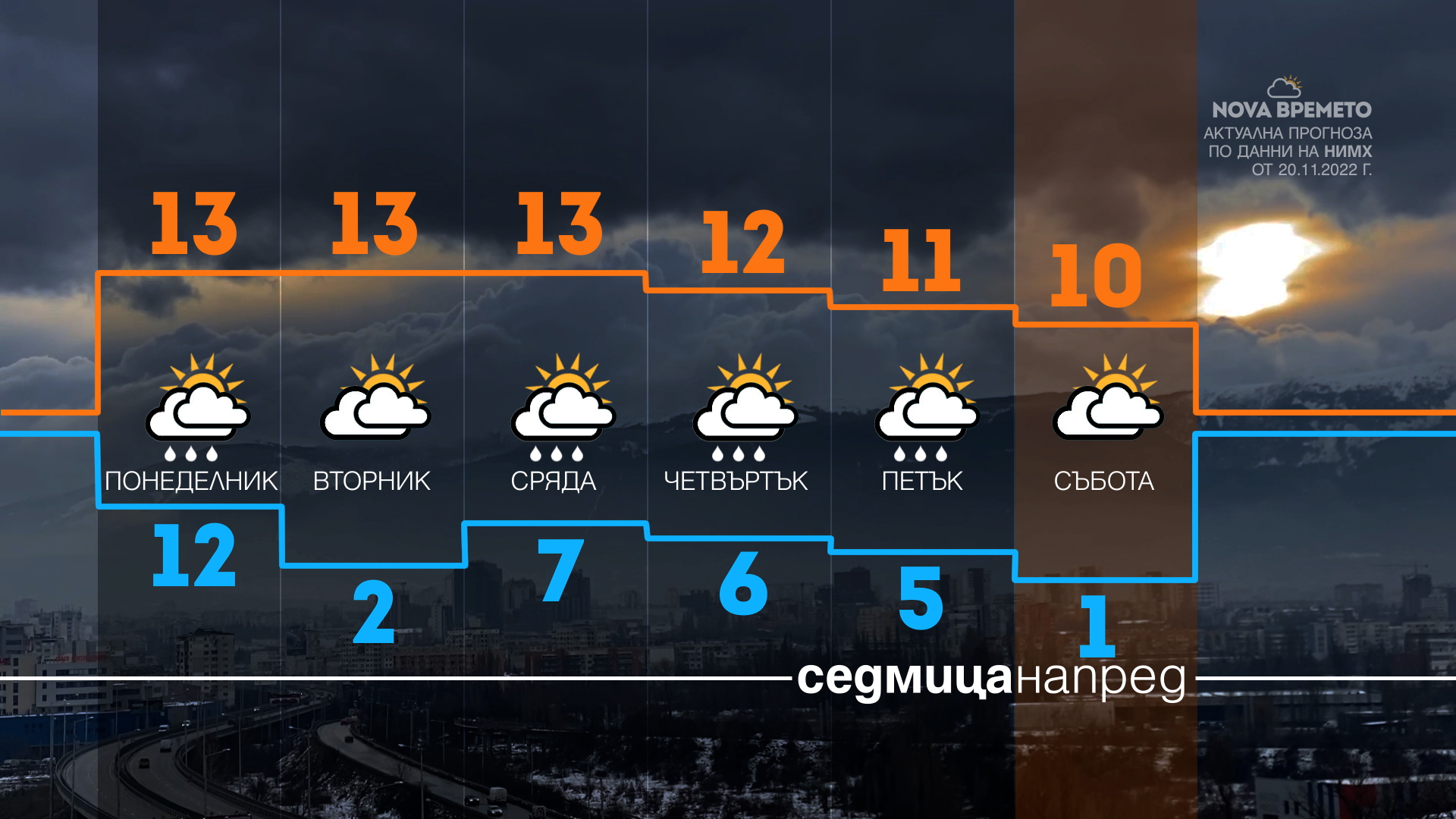
The rains that began on Sunday will continue into the night and on Monday, and by the end of the day they will be mainly in the southern and eastern regions. In the west, the clouds will open in the afternoon. Cold air will invade, with which temperatures will drop significantly. Then further up the mountain it will snow.

There will be fog on Tuesday until noon, but the sun will appear. In the afternoon it will be cloudy again. Another cyclone is expected to bring more rain on Wednesday and Thursday. Towards the end of the week the chances of rain will decrease, but temperatures will remain cooler with daytime values between 7 and 12 degrees.
You can see what the forecast is for your region HERE.


