Map Thursday.png
Weekend: winter gets stronger
Starting Friday, behind this bad weather system, a mass of cold air will cause thermometers to plummet and frost will return to the central area.
The environmental dryness that characterized this winter is still present but it is expected to ease from August.
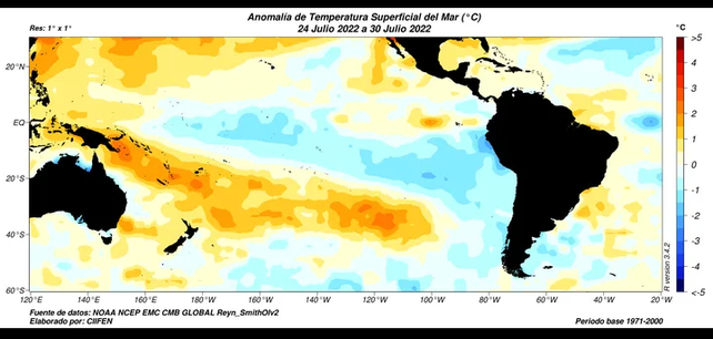
Although the trend for this month is once again for rains below average levels in most of the country, some precipitation begins to appear. The presence of La Niña, although somewhat weakened, continues to have a negative influence on the supply of moisture over the Argentine territoryso the systems that can generate some instability cause only limited events and in very restricted regions.
Bad news: La Niña in spring
The waters of the equatorial Pacific show a temperature below normal, which reaffirms the presence of the La Niña phenomenon at the beginning of spring. This situation anticipates few rains for the core region and an early spring with more marked cold air eruptions.
imagen 3.png

 – – –
– – –
