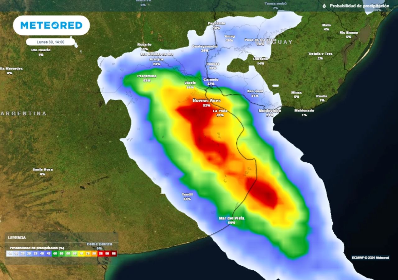
Locally strong storms are advancing this Monday the 30th through the province of Buenos Aires. Christian Garavaglia 09/30/2024 10:04 4 min
September culminates with a new event of great thermal contrast between the south and north of Argentina, promoting the development of significant weather in the central strip with the advance of a cold front.
During Sunday, temperatures reached the threshold of 40 °C in the north of the country as expectedin cities like Las Lomitas. At the same time Ushuaia, at the other geographical end of the country, it barely exceeded 2 °Cas a sign of the cold air that has been persistently entering Patagonia.
In the central strip of Argentina, a frontal zone advances towards the north this Monday, generating various phenomena, among which The Zonda wind over the Cuyo region stands out mainly, and the probable development of strong storms in Buenos Aires, the Federal Capital and the southern coast.
Orange alert for Zonda wind in Mendoza and San Juan
The province of Mendoza expects a relevant Zonda event this Mondaywhich will most likely descend to the plain and motivates suspension of face-to-face classes in schools in different provincial departments.
He official alert of the National Meteorological Service (SMN) extends today between Mendoza and Catamarca, but in the province of Mendoza and San Juan it takes on greater relevance given that reaches orange level by afternoon.
The Cuyo region expects strong gusts this Monday the 30th with the drop in the Zonda wind.
This implies probable winds of 50 to 65 km/h with gusts that can locally exceed 90 km/h, producing the classic sudden increase in temperature and a notable drop in humidity.
Tomorrow the south-southeast wind will enter strongly throughout the Cuyo region, conditions will stabilize, and temperatures will drop moderately.
At what time do strong storms arrive in Buenos Aires?
On Monday morning the cold front advanced through the Pampean region, generating isolated storms, especially affecting the south and southeast of Buenos Aires with varying intensity. The maximum rainfall values accumulated so far in the region were around 20 mm in the Tres Arroyos area, according to official data from the SMN.
In the rest of this day we expect the spread of these storm areas towards the north, fundamentally affecting the center and northeast of the province of Buenos Aires, Capital Federal, Entre Ríos and the south of Santa Fe. The further east you go, the more likely it is that these phenomena will reach strong intensity, with Potential for hail and/or strong gusts. The National Meteorological Service maintains an official yellow level alert for today throughout the indicated region.
In the city of Buenos Aires and the surrounding area, a maximum temperature of 28 to 30 °C is expected, and storms of a fairly isolated nature They would be arriving during the first half of the afternoon.then improving very quickly towards the evening.
Tomorrow, Tuesday, the entire central region of Argentina will register a moderate thermal drop, with marks that will become more normal for the season and under conditions of stable weather again, but somewhat windy.


