Jakarta, CNN Indonesia —
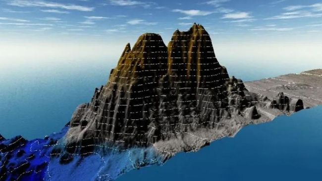
Experts found 19 thousand mountain undersea volcanoes using high-resolution satellite radar. This discovery makes experts now have a catalog mountain the most comprehensive volcano.
Prior to this discovery, only 1/4 of Earth’s ocean floor had been mapped using sonar. The sonar uses sound waves to detect objects hidden under the sea.
In 2011, the sonar found more than 24,000 seamounts formed by volcanic activity. But there are still more than 27 thousand seamounts that sonar has not yet mapped.
“It really boggles the mind,” said marine geophysicist at the Scripps Institution of Oceanography, David Sandwell.
Reported Live Scienceexperts no longer need to rely on sonar to investigate what lies beneath the sea.
By leveraging satellite radar, experts can also see what is lurking in the depths of the water, offering a better representation of the topography of the seafloor.
For this study, scientists took data from several satellites including the European Space Agency’s CryoSat-2 satellite (ESA). They found that these satellites can detect mountains under the sea even with a height of only 1,100 meters.
This figure is the lowest limit to designate something as a seamount. With this technology, scientists predict the height of a small volcano with an accuracy of up to 370 meters.
So far, scientists have mapped seamounts in the northeastern Atlantic Ocean that can help explain the evolution of the mantle plumes that feed Iceland’s more than 100 volcanoes.
The updated map will also provide a better understanding of ocean currents and “upwelling”, which occurs when water from the ocean floor churns upward to the surface – a phenomenon that scientists say can be “concentrated on seamounts and ridges.”
“There are a bunch of interesting things that happen when you have topography,” said University of Michigan in Ann Arbor physical oceanographer Brian Arbic who was not involved in the study. Science.
Experts have published their findings in the journal Earth and Space Science. Larry Mayer, director of the University of New Hampshire’s Center for Coastal and Ocean Mapping, said the new catalog of seamounts is a “terrific step forward.”
As well as being needed to navigate disasters, mountains store rare earth minerals that make them commercial targets for deep sea miners. Their size and distribution also holds clues about plate tectonics and magmatism.
“These mountains are important oases for marine life. “And they are ‘agitators’ that help control the large-scale ocean currents that are responsible for absorbing large amounts of heat and carbon dioxide, said John Lowell, chief hydrographer for the National Geospatial-Intelligence.
(lth)
[Gambas:Video CNN]
2023-05-01 11:00:12
#Thousand #Underwater #Volcanoes #Discovered


