A cold front will lower temperatures
Shortly before the end of March, we will feel another breath of the already past winter. An Arctic ice tongue will bring a dose of cold deep into the heart of Europe, all the way to some Mediterranean areas. Typical of spring, however, the cooling will not be long-lasting.
On Monday, a cold atmospheric front will pass over the Balkans. Over the course of the day, thunderclouds will develop from the northwest to the southeast with short-term, at certain times, intense precipitation with the risk of hail.
The wind will increase across the country – in the evening it will turn from the northwest and bring cold air and a feeling of colder weather. Daytime temperatures in the afternoon will still be high – between 16 and 21 degrees, but it will cool down later.
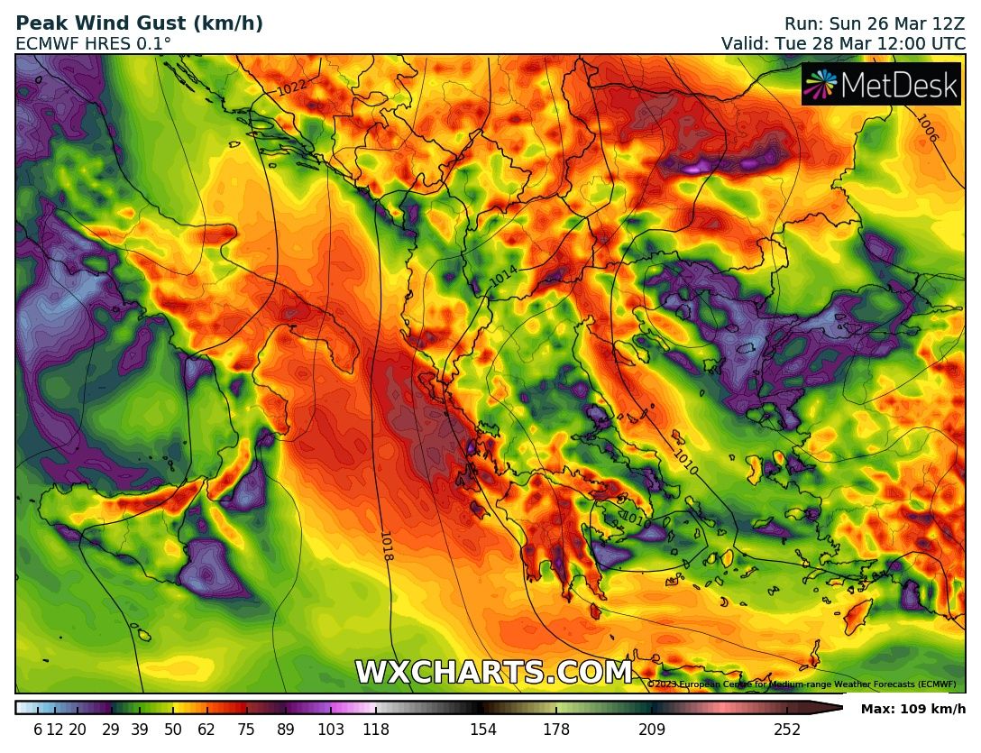
During the night and in the early hours of Tuesday, the drop in temperatures will create conditions for minor and short-lived spring snowfalls in the higher regions of Western Bulgaria. The day will be windy with dangerously strong gusts in the plains. And along the Staroplaninskyi, the wind speed will be over 100-120 kilometers per hour.

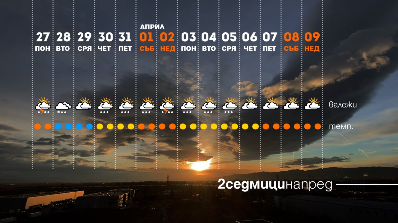
Both Tuesday and Wednesday will be cold with daytime temperatures between 5 and 10 degrees and values in the morning down to minus 5. Around the middle of the week, the cloudiness will be broken, and precipitation will be scarce.

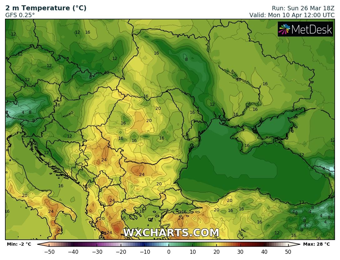
Literally the last days of March will be warmer with dynamic cloudiness, but minimal precipitation. A cold front with brief thunderstorms will pass in the very beginning of April past the day of reflection and the parliamentary elections. 2-3 windy days with lower temperatures will follow, after which on April 9-10 the thermometers will reach values around and slightly above 25 degrees.

You can see what the forecast is for your region HERE.


